SAEFARM : Satellite Plot MonitoringServices that apply this technology
Analyze daily cultivation status
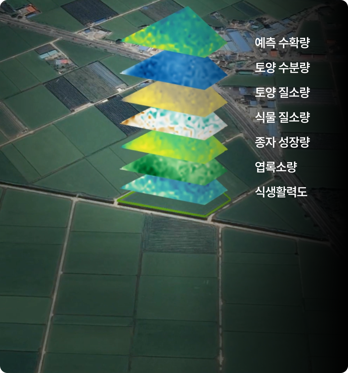
based on satellite data.Daily farming status
Soil status (soil moisture and nitrogen content, etc.),
Crop status (leaf size, chlorophyll content, seed growth, etc.),
Weather conditions are collected from satellite data.
Soil status (soil moisture and nitrogen content, etc.),
Crop status (leaf size, chlorophyll content, seed growth, etc.),
Weather conditions are collected from satellite data.
Analyze surrounding plots and collect annual satellite data
for each crop variety.When conducting plot analysis for individual farms, we also analyze surrounding farms in detail and collect annual satellite data for each crop variety. This allows farmers to receive objective farming reports based on accumulated data from neighboring farms.

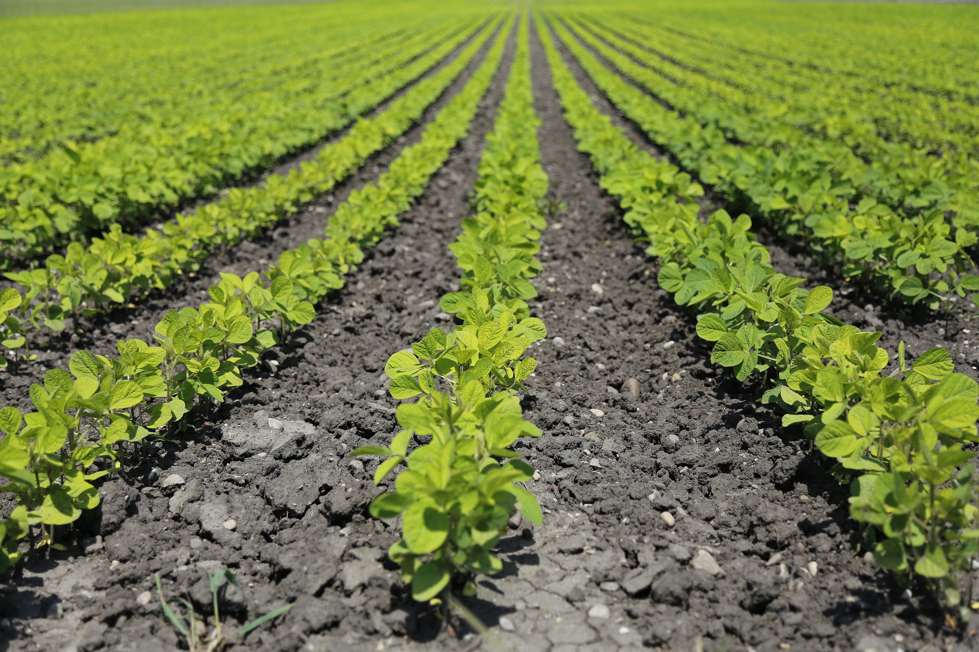
Trend of onion health changes
through vegetation index analysisBased on satellite photos, we analyze the state of farmland over the past 5 years to absorb the farming know-how of all farmers nationwide.
We provide consulting to establish the optimal farming environment by monitoring the state of farmland in real-time.
We provide consulting to establish the optimal farming environment by monitoring the state of farmland in real-time.

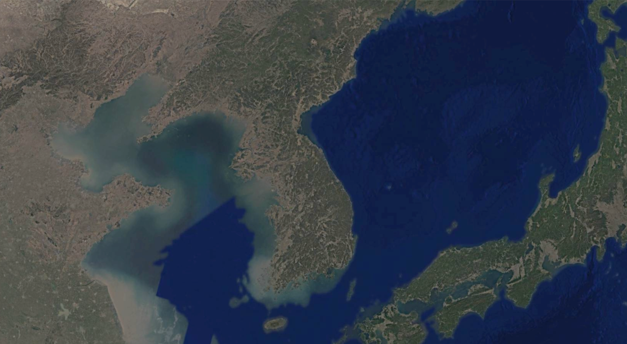
1.Learning from 500 million farmland data points across the Korean Peninsula through satellite imagery
2.Reading optimal yield through daily farming data of expert farmers over the past 5 years

3.Determining the best daily farming actions according to weather conditions
Pursuing sustainable agriculture
amidst changing Earth and weather.SAEFARM closely observes changing weather conditions and cultivation environments. We are developing sustainable farming methods to proactively respond to future changes, continually evolving by combining the latest technology with field experience
SAEFARM Co., Ltd.
1301, 151 Gasan digital 1-ro, Geumcheon-gu, Seoul, Republic of Korea(Gasan-dong, Sejin InnoPlex)Representative | CEO Seunghwan Jeong
Business registration number | 655-87-02755
Phone number | 02-6959-0820
1301, 151 Gasan digital 1-ro, Geumcheon-gu, Seoul, Republic of Korea(Gasan-dong, Sejin InnoPlex)Representative | CEO Seunghwan Jeong
Business registration number | 655-87-02755
Phone number | 02-6959-0820

Introduction
Technology
Service
Contact